Wednesday, July 30, 2008

Day 23: Memphis to Atkins, VA

Today was the second of three days with nothing but driving; so in an attempt to not have you fall asleep, drool, and cause irreparable damage to your keyboard, I've decided to devote today's post to the food we've encountered along our trip.


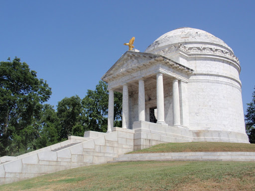
Food has always been a major attraction on this trip for us, which is why we made a rule very early on to avoid national chain restaurants whenever possible. And the first gastronomical geographic location of note was that of the Windy City, Chicago, home to Chicago style hot dogs and deep dish or "stuffed" pizza. Chicago is a tasty city. Chicago style dogs are not like the New York dogs most of us are used to; rather, they are more of a large vienna sausage on a poppy seed bun piled high with tomatoes, pickles, chilis, onions, relish, and mustard but NEVER ketchup; never ever. Deep dish pizza is actually a thin crust pizza that makes a right angle at the end of the crust, goes up for about 2 inches, and gets filled with tomato sauce, lots of cheese, toppings, and more sauce. BOTH are absolutely delicious! And you know what? It isn't even a matter of which tastes better New York or Chicago styles pizza or dogs; they're just completely different and both good in their own right.


Our next course was in Minnesota, the land of ten thousand lakes... and fried cheese curd. Yes, you read that right, fried cheese curd. I suppose you could liken it to fried mozzarella, but our opinion of its worth was split down the middle of the family, half liking it, the other half not. However, the walleye fish also calls the Upper Midwest home, and that we deemed good eats. (Copyright disclaimer if Alton Brown is reading this. Oh and Alton, if you are reading this, dude, you're awesome!)


But perhaps fried cheese and walleye are not in line with your pallette, may I entice you with a few Rocky Mountain Oysters? Yes, the most infamous of all mountain man cuisine, these deep fried buffalo or bull testicles are a delicasy in the Mountain West, but alas, the shock value was too much for my family and they would not allow me to partake in this regional fare. Shame. But if any of you try it, please tell what I'm missing.


Las Vegas was the buffet. Woohoo. Picture your normal buffet and triple its size; that's the grandeur of a Vegas buffet. I know I'm breezing through the buffet in this blog, but at the time, so did we.


Texas though was some of the best food of the trip. In San Antonio, Lori's and my families ate together at Mi Tierra, a Tex-Mex restaurant in the Mercado section of the city, which is essentially the Mexican cultural center. The margaritas were the best I've even had, the beef for the fajitas were rich with flavor, and the torillas were about as authentic as I think it gets. Should you ever stroll through San Antonio and get a little hungry, I strongly suggest you sit down at Mi Tierra and have a taste of the best Tex-Mex you've ever had. We eventually got to our Texas BBQ in Houston at Pappas BBQ, and boy, was it amazing! The sliced beef was the most tender we've ever had as it practically fell apart while we picked it up with our forks. You could taste the smokey goodness left in the meat after hours of cooking. These are the reasons why one goes to Texas and comes back five pounds heavier.


Lastly, we rode into Memphis. This stop above all others was solely picked for the quality of its food. Seriously, Memphis is out of the way when one is driving between Houston and New Jersey. It is, however, home of Memphis-style BBQ, which as we found out, is some of the most delicious food America has to offer the world. Memphis-style BBQ is one part long, smoking BBQ grilling and two parts delicious, savory, smokey sauce. We had our fill edible Memphis at Jim Neely's Interstate BBQ, consistently ranked as one of the top three BBQ places in the entire United States, and if I had my say, that ranking is probably still a little low- this place is simply the best ribs you will ever have in your life. In fact, my brother commented that now that we had had these ribs, what was the point of living life after it because life was only going to pale in comparison after this. Maybe he was right, but I won't be able to tell until I start cooking again for myself, which would probably kill me anyways. Oh well. Just remember this little maxim I heard once when you go out and try something new or different, "You have to live to eat, not eat to live."

Tuesday, July 29, 2008

Day 22: Vicksburg, MS to Memphis, TN


Driving Dist/ Time: 251 mi./ 3h 47min.

Sights Seen: Vicksburg National Military Park

Sights Missed: Everything else in northern Mississippi (whatever that was...)

We do the Civil War, and we do it often. We've done an entire family vacation in Virginia, a major portion of which was dedicated to the "Lee's Retreat" trail between Petersburg and Appomattox Court House; so the idea of doing an entire vacation without seeing something related to the American Civil War is kind of alien to us. Well, we remedied that today by visiting one of the most crucial victories for the Union during the War - the siege of Vicksburg. The story of the siege is actually quite straightforward. General Ulysses S. Grant led his Army of the Tennessee down through northern Louisiana to capture the Confederate stronghold of Vicksburg, MS, which was the last remaining stronghold along the Mississippi River that had not fallen into Union hands. While standing, Vicksburg allowed the Confederate troops to remain supplied as its port and rail connections led deep into the heart of Rebel lands. After Union frontal attacks on the town prooved fruitless, Grant established a siegeline outside of the city until the Confederate troops surrendered on July 3, 1863, 47 days after the siege had first been ordered.

In the many years since the siege, many monuments, memorials, placemarkers, etc... have been been erected to remember those on both sides who fought and died. Two of the most striking monuments were perhaps those from Missouri and Kentucky. The state of Missouri, while a Union state, also fielded a number of Confederate reigments; during the siege, there was one point were both Missouri Union and Confederate regiments directly faced and fought each other. To remember the soldiers from Missouri on both sides, Missouri established a monument to remember this one event. The state of Kentucky erected a monument in honor of both Abraham Lincoln and Jefferson Davis, the presidents on both sides of the war, both being born in the state of Kentucky. Perhaps a big fluke in the annals of American history, these two men were born less than 100 miles away from each other, about a year apart, yet led competing sides in a war of ideologies that tore a nation apart. To commemorate both of these men for the honor and courage to stand by their convictions, Kentucky erected its monument.

They say that the Civil War put brother against brother and father against son; nowhere did this seem more clear and evident than today at Vicksburg National Military Park.

States visited to date: 19
National Park Passport cancellations to date: 23

Monday, July 28, 2008

Days 20 and 21: San Antonio to Houston to Vicksburg, MS

Again, we have combined a number of days. If you remember the beginning of our trip, we made a "mad dash" for the Mississippi River; we have essentially done the same thing but in reverse.


We set out from San Antonio and headed for NASA's Johnson Space Center in Houston. Upon arriving, I have to admit my utter shock and dismay at what I saw; the majority of Visitor's Center was occupied by a giant ball pit and small ropes course called "Daredevil Island." This "attraction" had absolutely nothing to do with space or NASA, and to be honest, I was appalled that the Space Center was wasting space on this crap. Either way, they did have a tram tour of Mission Control, the Astronaut Training Facility, and the rocket garden at JSC, and we all thoroughly enjoyed it. Following JSC, we enjoyed some local Texas BBQ at Pappas BBQ and prepared for our first of three long-haul drives.


Which occurred today. Houston to Vicksburg was a loooooooong day. We drove through Southern Louisiana through the cities of Lake Charles, Lafayette, and Baton Rouge. We hit traffic in two of those cities and in a third place where a truck and caught on fire and brought the Interstate to a halt for over an hour. While the conversations that took place between us and the other drivers along the bayou was a nice way to kill the time until the traffice started to move again, I think we still would have preferred to have been continuing on our journey. Let's face it, traffic can occur absolutely anywhere and can be completely unexpected, and in reality, you just have to suck it up and deal with it because outside of the Northeast, the highway you're on is in all likelihood the only one that'll get you yo where you want to go. Just one more McNugget of wisdom for you to munch on. ;)

Sunday, July 27, 2008

Day 19: San Antonio

You may notice that there's no Day 18. You may notice that there's no mileage or sights seen for the mysterious, missing Day 18. Day was boring. We drove, a lot. You missed nothing. We went from Pecos, TX to San Antonio and saw nothing; seriously, even the Texans we know here asked us why we stayed in Pecos- we don't really have a good reason for it other than it got us closer to San Antonio.


So now, Day 19, as presented by guess writer, JeanneMarie McNamara:


"Well today, July 26th, your faithful blog composer decided to take a vacation from the vacation and is leaving the writing to his olde mom. After arriving in San Antonio [two nights ago] we decided to visit the one place everyone thinks of when they think of here - no, not the Lone Star Brewery but a place better known in history- the Alamo. While Deaglan for to visit the Japanese Gardens in Breckenridge Park with his girlfriend, [Lori], the rest of the Band on the trip traveled down the Missions Trail. In almost 3 hours we managed to visit 3 of the 5 original missions along the San Antonio River- starting in the hear of the city and the crowds at the Alamo, the site where the battle for Texas began. We then rushed off to Mission Concepcion and then to the best restored mission, San Jose y San Miguel.


We then rushed back to the hotel mid-afternoon meeting up with Deaglan and Lori and a friend of Kevin and Jeanne's - Anne Huth - a native San Antonian - for ice cream sundaes. Deaglan and Liam had not seen her since they were 6 and 2 respectively.


We then departed at 6pm to meet Lori's mom and Dad, [Irma and Jaime,] who had driven in from Midland, TX to enjoy an evening together at Mi Tierra."


That is all loyal listeners, until tomorrow!

Friday, July 25, 2008

Day 17: Las Cruces, NM to Pecos, TX


Driving Dist/ Time: 193 mi./ 3h 32min. (to Carlsbad Caverns NP); 103 mi./ 1h 52min. (to Pecos)

Sights seen: Carlsbad Caverns National Park

Sights missed: Guadalupe Mountains National Park

It was a border mission. The McNamara family was called on by the Commander-in-Chief himself to personally survey the Texas-New Mexico border between El Paso and Carlsbad; when the Chief calls, you answer! We proceeded from our rally point in Las Cruces toward the population center of El Paso. Following well-marked routes through the city, we followed the directions of our military-grade GPS device, CODEWORD: TOM TOM. We checked in with the US Border Patrol about an hour outside of El Paso only to be held up in traffic due to suspiciously placed road construction an hour later; the Chief would not be pleased by the delay. After the "construction," we learned of an infiltration of illegal immigrants in Guadalupe Mountains National Park, to which we immediately responded. Upon arriving at the Park, we found a makeshift barricade erected at the entrance the park; it seems the Border Patrol had already responded, was going to "neutralize" the threat, and that we were not needed and were allowed to continue on our original mission. Once entering Carlsbad Caverns NP, we immediately obtained the high ground and Mom was sent out to perform a 360 degree recon of the area. Once deemed safe, we assaulted the main bunker with "Visitor's Center" on the front (heh, cheap ruse!) and interrogated the militants inside. Their uniforms very much resembled the US Forest Service's uniforms, but we could also see through this ruse. We ventured further into the bowels of the bunker, which seemed to be connected by a 750ft. tall elevator shaft to enormous underground Caverns with amazing displays of speleothems (stalagmites, stalactites, etc...), and while we were there, people were down here as well, they did not wear the uniforms of the militants above and they seemed more interested by the cave formations than of any malicious plots in the making. After surveying the caverns for approximately 2 to 3 hours (and taking the just recently declassified photographs now in the photo album), we left the Caverns. The TOM TOM sent us down a non-upgraded, dirt road, which did not suit our non-military grade vehicle well and were then forced to find an alternate route. We soon thereafter made camp for the night and filed our report to the Chief.

Well, it may not have happened exactly as stated here, but take out the military charm and find an accurate depiction of the trip (and yes, we were stopped by the US Border Patrol deep within Texas. Seriously though, see the pics; it's the best way to get a feeling for what we saw.

States visited to date: 16
National Park Passport cancellations to date: 20

Thursday, July 24, 2008

Day 16: Scottsdale, AZ to Las Cruces, NM


Driving Dist/ Time: 111mi./ 1h 56min. (to Saguaro National Park); 305mi./ 4h 31min. (to Las Cruces)

Sights Seen: Saguaro National Park

My brother found a post card in one of the gift shops earlier in our trip. The picture was of a car driving along a road in the distance with two cacti in the forefront, both with their arms hanging lazily to the side with one cacti saying to the other, "Quick! Put up your arms, the tourists are coming!" At this point, my brother and I became determined to sneak up on a cactus and catch it off guard with its arms drooping. Well, as we learned from Saguaro NP, the ones with arms drooping are in fact either sick, dead, or mutated... oh... that's no fun... But our trip to Saguaro was certainly no wash because we were able to see some truly amazing stuff. Saguaro, name after the Saguaro cactus, is home to many different types of the green, prickly plant including the saguaro, barrel, cholla, and prickly pear cacti. Additionally, the Park contains a variety of other desert flora and fauna including the ocotillo plant (seen in the picture above next to the cactus) and the Lesser Long-Nosed Bat, an endangered species which has made its home in the Park. At many points along the 8-mile driving tour route, the visitor gets an opportunity to see spectacular individual specimens of cacti as well as fields and valleys filled and teeming with cacti as if it were a forest. Perhaps to native Arizonans, this Park is not much to write home about, but for a couple of Northeasterners who never seen anything like it, Saguaro was a unique experience and a bit of desert life not to be missed.

States visited to date: 15
National Park Passport cancellations to date: 19

Las Vegas, NV through Scottsdale, AZ


Viva Las Vegas! Well, kinda. You may have noticed that the title for this section is slightly different from other posts. Well, that’s because it is different. This section of the trip predominantly takes place in the area of the home of my Uncle Brian in Scottsdale, AZ. Vegas, despite all of its allure, was only a one night stopover for us. No gambling, no shows- just the buffet. You may say that we cheated ourselves, didn’t really experience all that Vegas has to offer, but you know, we didn’t think so. We needed a place to stay and then move on to Scottsdale; for our purposes, Vegas was everything we wanted it to be.


Leaving Las Vegas, we headed towards Hoover Dam. Word to the wise- if you see Hoover Dam, prepare for pain. Lots of pain and in many forms. First, you will encounter the pain of lots of traffic. You see, the road over Hoover Dam is the most direct route between Las Vegas and Arizona, which doesn’t seem like much until I remind the reader that Nevada and Arizona are the two states with the fastest growing populations. So it does not take much imagination to picture the hordes of cars trying to pass over the two-lane road over the dam and the annoying traffic it causes. Second, you will deal with the most accident prone people that each state has to offer. Hoover Dam and the Grand Canyon are probably two of the most iconic American vacation spots and therefore it lures all types of people from all across the States to it like moths to a fly zapper. People will frequently dart in front of traffic to get from one side of the Dam to the other despite the Hummer that is barreling towards them. Survival of the fittest might be a great theme for this section of the trip, but I hear that the Theory of Social Darwinism is generally discouraged these days, so I shall not advocate it either. To be honest, there’s not much else to say about the Dam; it’s big, it holds back a big lake, tons of stupid tourists. Oh, you can always get a tour of inside the Dam, and I’m sure it’s impressive, but we just took our pictures and went on our merry way into the enchanted land of Arizona.


Now this lovely state, part of the extended South (take it Crystal!), is actually nothing like the desert anecdotes you may have heard of in pop culture. Following the most direct route between Vegas and Scottsdale will take you through the heart of Arizona’s Joshua Tree forest, an absolutely stunning land filled with stunted, gnarled trees that can only be described and ugly by itself but amazingly beautiful as part of its surroundings. With the occasional cactus around as well, I think we felt the Joshua Tree forest was an unexpected delight that we perhaps enjoyed even more than Hoover Dam. We soon thereafter arrived at my uncle’s house and just had some genuine good times with family.


The next day (no, this post is not over just yet), we made our way to the Grand Canyon, and let me tell you, the route took us through a part of Arizona that I didn’t know existed in Arizona; did you ever think there would be a pine forest in Arizona? The northern section of the state is much cooler than the desert south, which allows for the evergreens trees to flourish. In fact, when we left Scottsdale at 7:30am., it was 90 degrees and when we got to the Canyon, it was down to 74. But temperatures aside, the Grand Canyon is truly grand! Words like ‘large’ or ‘big’ or even ‘enormous’ do not accurately describe what the Canyon really is because it isn’t just a big hole in the ground, it’s magnificent in size and in beauty. We’ve all seen the pictures of the Canyon, but you really can’t get a feel for the place until you’ve actually been there in person. And yes, once you seen the big hole in the ground and soaked in its wonder for three hours, it really does become just a big hole in the ground, but for those three hours, the journey, entrance fee, and lifelong wait all become worthwhile. There other things to do in the area such as the IMAX video of the Canyon (highly recommended), the Grand Canyon Railroad (also recommended for railroad buffs), plenty of hiking trails and whitewater rafting. In the end, it doesn’t matter what you do do at the Canyon, just don’t miss it! Ever! Go now! Really, I meant it; what are you waiting for?

States visited to date: 14

National Park Passport cancellations to date: 18

Day 12: Cedar City, UT to Las Vegas, NV


Driving Dist/ Time: 58.1 mi./ 1h 9min. (to Zion NP); 164 mi./ 2h 45min. (to Vegas)

Sights Seen: Zion National Park

First of all, my sincerest apologies to all of the readers for the recent absence of posts. We all knew it would happen, just not when or where, but the free-flowing river of free internet access dried up upon crossing into the city limits of Las Vegas, Nevada. My uncle’s place in Arizona was also devoid of wireless, thus preventing these posts from getting online. That said, we’re now back and ready to continue reporting on the cramped conditions of the minivan… as well as other things…


Upon leaving Cedar City, our now recalculated itinerary for the day called for a relaxed day in Zion National Park. Zion is in the middle of what geologists have termed “The Grand Staircase,” which is the geological stepped lowering of elevation in the Colorado Plateau; to put it in terms of how it was explained to us, the bottom of Bryce Canyon is the top of Zion National Park, and the bottom of Zion is the top of the Grand Canyon. But beyond the geologic terminology, Zion is probably one of the most beautiful locations we have visited on this trip. Other locales were stunning for the uniqueness of the strata, rock formations, vegetation, etc… Zion was beautiful not because it have something that was unique but because all of the above was found in one place. The canyon walls of Zion stretched up thousands of feet above the river bed, thus revealing the striking rock strata hidden underneath the tall peaks. Water from hundreds of years ago came from the porous sandstone rock in places, almost as if crying, while the mixture of trees, bushes, and other vegetation survived on what little water was provided to it from rain throughout the year. The hundred degree temperatures did not deter us, as by now we had become seasoned veterans of how to survive the environments with our filled water bottles and better understandings of the limits of how far our bodies could actually go. All in the, we left the park feeling good, relaxed, and without remorse that we had missed Bryce Canyon due to the previous day’s lodging issues because we were able to enjoy Zion that much more. We were good.


States visited to date: 13
National Park Passport cancellations to date: 14

Saturday, July 19, 2008

Day 11: Moab, UT to Cedar City, UT


Driving Dist/ Time: 5.5mi/ 9min. (to Arches NP); 30.1mi/ 43min. (to Canyonlands NP); 284mi./ 4h 5min. (to Cedar City)

Sights seen: Arches NP, Canyonlands NP

I dislike the idea of starting a post with a negative thought, especially when it has nothing to do with the wonderful things we saw today, and they were wonderful, but we as a family need to vent on one subject- the newfound hatred we have for the Best Western chain. Now, I am hater; I am lover- a lover of fine cuisine, a lover of nature’s finest displays of beauty, but right now, I am a lover of a large number of four-letter words and they all directed at Best Western. This hatred is not unfounded; nay, it is predicated on the notion of complete ineptitude and lack of customer service. For this trip, our family booked four separate Best Western hotels over the internet, along with all of the other hotels for this trip; Best Western was the only one to get the dates of our stay wrong. And no, these temporal errors were not mistakes of a day or two, but rather of two months. Now we caught their mistake in three of the four hotels; that is until tonight when we attempted to check into our hotel outside of Bryce Canyon National Park, when we found out that we were two months late for our stay. This was news to us. Given no assistance and told that they were completely booked, which judging from other hotels we passed, so was the entire region, we were kicked to the curb with nowhere to go for the evening. Thank to teamwork and a AAA tourbook, we were able to locate lodging just under two hours away. This unplanned detour in our trip has now axed Bryce Canyon from our itinerary and simply has put comfort levels at an all-time low as we will stroll into our lodging around 10:30pm Mountain Time, 12:30am Eastern. So that said, we officially discourage the use of the Best Western hotel chain in your roadtrippin’ plans.


Oh yeah, today… right… I guess it wasn’t all bad. What did we do again, Liam? Oh yeah, we saw some rocks, pretty rocks, ‘hole’y rocks you might say. First stop for the day was Arches National Park, and I know I’ve called a lot of things ‘unique’ on this trip, but this stuff takes the cake. Arches NP contains a wide display of natural stone formations including buttes, but most notably natural stone arches- over 2,000 as a matter of fact. There’s no possible way to describe with words the majesty of these formations; so I implore you to go to the photo album for today and see the pictures for yourself. You’ll be grateful you did. Following our expedition in Arches NP, we journeyed 30 miles up the road to Canyonlands National Park, which encompasses the confluence of the Green and Colorado Rivers. To put the sheer natural importance of this fact into perspective, there are three main river systems which drain all of the water from west of the Rockies- the San Jacinto drains California, the Columbia River drains Oregon, Washington, Idaho and Montana, the Colorado and Green River system drains everything else and provides water and electricity for pretty much every southwestern and central western state. The confluence of the two rivers in Canyonlands NP plays an enormous role in the natural ecology of the West. Canyonlands itself, as the name implies, is filled with the natural canyons formed by both of the rivers as well as water run-off which the arid desert soil cannot absorb. The rivers have eaten away at the sandstone layers over the hundreds of millions of years of geologic formation (also known as the average time span of a single failed military spending program) to reveal the various colors and thicknesses of each line of strata. Information from these superficial observations goes far in determining the geological history of a given area and has done so for the Colorado Plateau, which averages a height above sea level of 5,000 ft. Seeing these canyons gave us a fantastic preamble of what to expect in a few days when we go to the granddaddy of all canyons, the Grand Canyon (and yes, we hope to be able to tell you afterwards what is so ‘grand’ about it anyways).


So with a long sigh and still feint hope for tomorrow, we bid all our reader(s) a good night; after all, at least one of us should be able to get some sleep.

Friday, July 18, 2008

Day 10: Denver to Moab, UT


Driving Dist/ Time: 268mi./ 4h 14 min. (to Colorado NM); 104mi./ 1h 39min. (to Moab, UT)

Sights seen: Rocky Mountains; Colorado National Monument

There are a lot of scenic roads in America. From the Blue Ridge Parkway of Virginia and North Carolina to the Pacific Coast Highway, Americans have always placed a premium on seeing beautiful bits of nature from the comforts of their automobile as they guzzle copious amounts of fuel. This is also very true of I-70 as we learned as we crossed the Continental Divide today. This major asphalt artery crosses the continental divide at over 11,000 ft. and proceeds to wind its way through the Rockey Mountains along the course of the upper reaches of the Colorado River. As we continued our trek along this road, we came across the like of Vail and Eagle, Colorado, until we reached the primary goal of our day's journey, Colorado National Monument.

Colorado NM offers the visitor a variety of geological formations, most notably Monument Canyon (pictured above), which runs the length of the park. Aditionally, the Monument offers the visitor miles of hiking trails and fantastic vistas of Grand Mesa, the world's largest mesa with an area of approximately 500 sq. miles. With the unique and breathtaking views of the Mesa, the Canyon, and the Colorado River Valley as a whole, Colorado NM offers a great taste of the natural wonders that are to come along the rest of the Colorado Plateau.

States visited to date: 11
National Park Passport cencellations to date: 11

Wednesday, July 16, 2008

Day 9: Scottsbluff, NE to Denver (via Rocky Mtn. NP)

Driving Dist/ Time: 198mi./ 3h 38min. (to Rocky Mtn. NP); 73 mi./ 1h 38min.


Sights seen: Rocky Mountain National Park


From amber waves of grain to purple mountain's majesty, our family traversed the last few miles standing in between us and the Rocky Mountains and visited Rocky Mountain National Park in the process. Located northwest of Boulder, CO, Rocky Mountain NP is home to one 14,000 ft. peak (Long's Peak) and number 12 and 13,000 ft. peaks. The park also contains fantastic vistas and areas of alpine tundra, which is only located on areas above 10,500 ft. in elevation, or above the tree line. A paved two-lane road takes the visitor from the entrance of the Park at 7,500 ft. to the visitor's center at the top of the ridge at 11,796 ft., making it the highest visitor's center in the National Park system. The vistas of the moutains, valleys, and graciers throughout the park are assuredly unsurpassed by anything we've seen thus far, as demonstrated by the above picture of Bear Lake, located in the Park at an elevation of about 9,500 ft. There are a lot of places to see the Rocky Mountains at their finest; this is certainly one of them!

States visited to date: 11
National Park Passport cancellations to date: 11

Day 8: Hill City, SD to Scottsbluff, NE


Driving Dist/ Time: 179mi./ 3h 18min. (to Ft. Laramie NHS); 76mi./ 1h 32 min. (to Chimney Rock NHS); 23mi./ 35min. (to Scotts Bluff NM)

Sights seen: Fort Laramie National Historic Site, Chimney Rock National Historic Site, Scotts Bluff National Monument

'I tried to ford the river, but my friggin' oxen died!' Ah yes, we all know that phrase, and I don't know how many times I said it during the self-proclaimed, "Oregon Trail Day!" Yes, this day was dedicated to honoring the over 250,000 people who crossed the "Great American Desert" to resettle in the far-off lands of Oregon, California, and the Salt Lake Basin. First stop on this homage was Ft. Laramie, Wyoming (yes, there's something to do in Wyoming). This fort was the preeminent military installation for the northern and central Great Plains. It was a primary stop on the Oregon, California, and Mormon trails; it was site of two major Indian treaties, one which established safe passage for all American emigrants travelling westward; and it was one of the most important locations on the Pony Express and transcontinental telegraph routes. A very amazing site considering all the history that passed through its environs.

Chimney Rock and Scotts Bluff are two major landmarks along the Oregon, California, and Mormon Trails. These enormous and unique landmarks located along the North Platte River in the plains of the panhandle of Nebraska were welcome sites to the travellers who had seen nothing but flat, barren land for two months after they left the civilization of the East. Anyone who played the Oregon Trail game(s) knows the importance of these icons along the route and just seeing them in person, just like hundreds of thousands of emigrants had seen before, really put the history of the growth and formation of this nation in perspective. Oregon Trail day cannot be missed!

States visited to date: 10
National Park Passport cancellations to date: 10

Tuesday, July 15, 2008

Day 7: The Black Hills


Driving Dist/ Time: N/A

Sights Seen: Jewel Cave National Monument, Crazy Horse Memorial, Mount Rushmore National Memorial

Sights Missed: Devil's Tower National Monument, Deadwood, Wind Cave National Park, Custer State Park, National Woodcarving Museum, 1880 Train Ride, and I'm sure a number of others.

Beautiful. Awestriking. I've decided that I have said these words too many times already. But here's my problem- I don't know how else to describe most of the stuff we're seeing out here. We began the day by going to the second longest cave system in the world, Jewel Cave National Monument. (What, pray tell, is the longest? Mammoth Cave in Kentucky). Now we did not stroll through all of its over 140 miles of passageways, but rather took the 1/2 mile guided-tour version, which we felt gave us an excellent example of why this cave is called what it is, for you see, over 90% of Jewel Cave's surfaces are covered in calcite crystals. WARNING: SCIENCE AHEAD... All caves are formed by slightly acidic water eroding stone away. Now, most caves are formed by flowing water which give them the classical cave forms of stalactites, stalagmites, and flowstones. However, Jewel Cave was formed by standing water, which meant that as the water eroded the calcium from the cave's limestone surfaces, the now calcium-rich water just stayed there. Over time, the calcium would redeposit itself onto the walls in the form of calcite crystals, making Jewel Cave one of maybe a half dozen caves in the world of this type. END SCIENCE... Needless to say, Jewel Cave is a truly unique, and yes, beautiful site to see.

Once back atop of God's green earth, we went to see the Crazy Horse Memorial. Once completed, this statue to the great Lakota chief, Crazy Horse, will measure in at 563 ft high, making it the largest statue in the world. For comparison's sake, the entirety of Mt. Rushmore will fit inside Crazy Horse's head; it will also stand taller that the Washington Monument, the Statue of Liberty, and the Egyptian Pyramids at Giza. To be completely honest, while we have absolutely nothing against a memorial to the Lakota, we find it somewhat hypocritical that the descendants of this man are honoring him by dynamiting the same sacred hills he wished to protect in his name. Despite this, Crazy Horse is definitely something to see, and while there are some exhibits and Native American art displays (mostly art displays) at the site, we suggest forgoing the $27 fee to get in and take a perfectly decent (and free) photo of the memorial from the main road (see the sunset photo my mother took in the photo album for an example).

After honoring a great Native American, we decided to honor some people we knew a little better from history class and drove on to Mt. Rushmore, and it was amazing! We've all seen the Memorial from movies and all sorts of media before, but it is NOTHING like being there and seeing it firsthand. Just looking around you, you can see the Black Hills towering over the surrounding landscape, truly a monument to God's handiwork, and here, in front of you, is a small homage to four men who formed, sustained, and made this nation great! The 3 million visitors a year who come to Rushmore can't be wrong; so this is definitely a must see for any cross-country traveller.
States visited to date: 8
National Park Passport cancellations to date: 5

Monday, July 14, 2008

Day 6: Mitchell, SD to Hill City, SD


Driving Dist/ Time: 204mi./ 2h. 55min. (to Badlands)
105mi./ 1h. 44min. (to Hill City)

Sights Seen: Badlands National Park, Wall Drug, even more corn

"For those about to rock, we salute you!" These immortal words from AC/DC drifted into my head yesterday as we entered Badlands National Park for on this day, we were to truly rock out! Badlands are a type of arid terrain where softer rocks and clay-rich soils have been extensively eroded by wind and water and can be found all over the world, including Italy, New Zealand, and other places in central North America. What we saw in Badlands NP was the full range of what natural erosion can do to rock including the sharp buttes pictured above (for a size comparison, those little tiny colored dots you may see in the gap between the buttes are in fact individual persons) and multicolored lines of strata that seem to permiate throughout each rock formation. The thirty miles of paved road that weaves in and out between these megaliths and gullies illustrated the sheer force of wind and water and what we usually consider some of the hardest substances on earth- rocks. In fact, the Badlands are still eroding, in some places up to one inch a year, but that didn't stop us from climbing on some of the formations and taking awesome pictures! (see photo album) My mother, who has been in some pain of late for having to sit in a car for the long amounts of driving hours, commented once in the park that this one spot had already made all the pain she endured completely worth it. You know, even in the destruction of something I'm sure was beautiful thousands if not millions of years ago, the resulting product was something that was still tremendously beautiful in its own way, and I'm sure that in thousands of years from now while the formations and rocks continue to change, the reultant will still be something awestriking and beautiful again.

As we left our rock portion of the day, we rolled on into Wall, SD, right outiside the Badlands, to go to Wall Drug. Now you may ask... WHY?! What's so special about a drug store in South Dakota? Well if you had been riding with us in the car since Minnesota, you would have asked that question 355 miles ago when we saw the first billboard for it! You see, Wall Drug has been famous since the 1930's when it first advertised "Free Ice Water" for thirsty travellers on their way to Mount Rushmore. Since then, they've expanded their offers to "5 Cent Coffee" and expanded their selection way beyond pharmaceutical solutions and now includes every novelty, trinket, souveneir, and tchotchke of roadside Americana that the South Dakota can afford to offer. Business is so strong that we noticed a lot of employees came from 20 miles away or more and some even from Eastern Europe. Also prevalent in the store are the occurrences of stuffed jackalopes. (For more on the jackalope, please see http://en.wikipedia.org/wiki/Jackalope) This little indulgence is just another piece of Roadside America that simply can't be missed. So if you ever find yourself in eastern South Dakota, I strongly recommend a stop for some ice water or coffee and have a little fun.

States visited to date: 8
National Park Passport cancellations to date: 3

Saturday, July 12, 2008

Day 5: Rochester, MN to Mitchell, SD


Driving Dist/Time: 234mi./ 3h 52min. (to Pipestone)
116mi./ 1h 50min. (to Mitchell)

Sights seen: Pipestone National Monument, Corn Palace

My girlfriend's mother, who had lived all her life in New Mexico and Texas, once remarked upon flying into a Washington, D.C. airport that the landscape was so beautiful; that the trees, the grass, the flowers were all just so plentiful and bountiful. When my family set out from Rochester this morning and set out west as we had done many days now, the trees grew fewer in number, the grasses had gotten taller and brownish, and the flowers we were used to had morphed into ears of corn. And despite this new, alien landscape, it was still beautiful. A steady wind blew through the prairie grasses and caused it to undulate like waves on the ocean, and nowhere was this more obvious than at our first stop of the day, Pipestone National Monument.

The Pipestone quarries have been a sacred place for American Indians for hundreds, if not thousands, of years. It is home to a special type of rock which formed from pressured clay and is and has been desired for its unique red tint and easy workability into many objects including trinkets and smoking pipes (hence 'pipestone'). The Dakota Sioux (or Lakota) believe(d) that the Great Spirit was displeased by the warring of the American Indians and directed its followers to use the rock from Pipestone to create an instrument of peace (the peacepipe) and to keep the quarry lands sacred and peaceful, which it has remained to this day. Our visit to Pipestone gave us an interesting look at the culture and traidtion of the North Plains American Indians, something completely new for us.

After leaving Pipestone, we sped west yet once more for Mitchell, South Dakota, our home for the night as well as home of the self-proclaimed "World's Only Corn Palace." Now wait one second before you go gettin' all judgemental on me. Think about it! You thought the bicycle from yesterday was cute, this is still cute, just on a much grander scale. The Corn Palace was originally built in 1892 to demonstrate to America and to the world the rich soil that South Dakota had to offer farmers by creating beautiful murals on the sides of the building... in corn. Yes that's right, corn. Each year the mural is changed through today when the current mural theme of "Everyday Heroes" will be replaced by "American Landmarks" and the thirteen different types of colored corn husks which will decorate the murals. You may think it's hokey or corny (seriously, how could I resist?), but it is truly a piece of Americana that I dare you to find somewhere else!

States visited to date: 8

National Park Passport cancellations to date: 2

Day 4: Chicago to Rochester, MN (via Wisconsin)


Driving Dist/Time: 180mi./ 3h (to Wis Dells)
156mi./ 2h 28min. (to hotel)
Sights Seen: Dells Boat Tours, Wisconsin Dells, WI
Sights Missed: An unspeakable amount of cheesemaking factories

As we said our goodbyes to Chicagoland, we all looked forward to the adventures that lay before us in Wisconsin and beyond the mighty Mississippi River. We had never driven across the Mississippi before in any of our travels; so this is where everything became absolutely new territory for us. However, Wisconsin stood in our way.

When we tried to consider places to see in Wisconsin (we forgot to get a AAA tourbook), we shamefully came up with very little. We did not know much about what there was to do in the state other than their fine cheesemaking skills and seeing a Green Bay Packers game. Despite the drama of recently finding out that Brett Favre wanted to return to the NFL, but not to the Packers, this was not a sight corporial enough for a visit, and the Packers games haven't started yet. But then we remembered a place a Wisconsin friend of mine had mentioned, Wisconsin Dells. And folks, let me say that I was VERY glad he did mention it because it was something our family would never have wanted to pass up! This natural wonder on the Wisconsin River in south central Wisconsin wonderfully presents a small history of the lumber industry in the region as well as beautifully illustrates the rock strata of the region along the shores of the river. My family took a one-hour tour of the Lower Dells; however, there is also a two-hour Upper Dells tour which allows for a short hike through "Witch's Gultch" as well as Duck tour through the Dells. All in all, I believe my family owes the great state of Wisconsin an apology for not giving enough credit to the State for all the wonders it has for the beholder.

Oh yes, and the picture is from Sparta, WI, the self-proclaimed "Bicycle Capital of the World."

States visited to date: 7
National Park Passport cancellations to date: 1

Friday, July 11, 2008

Day 3: Chicago


Driving Dist/Time: N/A

Sights seen: Wrigley Field, Museum of Science and Industry

Sights missed: Too many to recount

Chicago, the windy city. Although it wasn't too windy the day we were in town... Either way, this large metropolis, the third largest population center in the United States, is home to many great landmarks and attractions for the daytripper and roadtripper alike. We believed that a trip to Chicago would not be complete without a visit to the hallowed grounds of Wrigley Field, pictured above (you may notice that a lot of the sports attractions we see on this trip will be described as hallowed; I'm the writer so I get to do that.) However, due to the apparent day game that was starting as we got there, our visit was limited to the view afforded to us during a red light at the intersection in front of the stadium.


Following Wrigley, we proceeded to the Museum of Science and Industry for a few hours with the intent of taking a Chicago River and Lake Michigan cruise following it. The MoSI was everything and more than the reputation that preceded it. The Museum contained a large number of exhibits and displays covering scientific and technological areas from an interactive exhibit of the inner workings of a coal mine to cloning and genetics to railroad history to space endeavors past, present, and future (and as a Space policy person, I must say that I found their space exhibits VERY impressive, perhaps second only to the National Air and Space Museum in DC and displays at the Kennedy Space Center in Florida.) However, after spending four enjoyable hours in the Museum, we left excited about the river and lake cruise awaiting us; that is until we got outside and found rain, thunder, and lightening awaiting us, which cancelled the cruise. So while we didn't get to see everything we had intended to, it was nevertheless and enjoyable day and one which has already made us want to come back to see all the things we missed.

States visited to date: 5

National Park Passport cancellations to date: 1

Thursday, July 10, 2008

Day 2: Youngstown, OH to Chicago, IL


Driving Distance/Time: 60mi./ 1h 1min. (to HOF)
407mi./ 6h 39min. (to hotel)
Sights seen: Pro Football Hall of Fame, Canton, OH
Sights missed: Cuyahoga Valley National Park, Perry's Victory and International Peace Memorial, the College Football Hall of Fame, and Indiana Dunes National Lakeshore.

Ah, the Ditka! This bust in the HOF is actually for his days playing as a tight end in the NFL and not for his days coaching the Chicago Bears (and definitely not for his days with the Saints...) But Ditka is just one of many great stars honored forever in the hallowed halls of Canton for their athleticism and intestinal fortitude on the gridiron. The HOF covers the rich and extensive history of professional football in the United States, including defunct and existing teams and leagues, great stars of days past, and the changes that occurred within the game as years progressed, such as new rules and better body padding, etc... And this is primarily why we came here.

However, as you can see from the note above, we passed over a number of equally enticing and unique attractions between Youngstown and Chicago. I mean, who wouldn't want to take a train ride through lush river valley that had once in its infamous history been on fire (Cuyahoga Valley NP), stand atop a 352ft. tall monument on a small isle in the middle of Lake Erie (Perry's Victory...), see the great college football stars before they hit the pros, faltered, and got arrested for cocaine use, or even see 125ft. tall dunes not at the beach but on the edge of a lake (Indiana Dunes NL). The truth is, if we had had more time, we would have liked to have seen them all, and perhaps on your trip, you will have the time or the desire to make these side trips a part of your planning. Either way, I strongly suggest these sights as they each present a completely unique experience that you would be hard-pressed to equal.
States visited to date: 5
National Park Passport cancellations to date: 1

Tuesday, July 8, 2008

Day 1: New Jersey to Youngstown, OH

Driving Distance/Time:
286mi./ 4h 45min. (to APRR)
152mi./ 2h 56min. (to hotel)

Sights seen: Allegheny Portage Railroad National Historic Site

Today began our arduous journey across this great nation of ours, and it was a good preparation for things to come. First, today's drive was a long one, and we all got very used to the idea of sitting in one spot for a long time and how to properly break up such a drive into smaller chunks through meal breaks, gas station fillups, and attactions. Today's attraction was the Allegheny Portage Railroad National Historic Site in Gallitzin, PA. Being the connecting piece of the Pennsylvanian Main Line Canal over the Allegheny Mountains, the railroad has been hailed as one of the premier engineering achievements of the nineteenth century and has transported such famous people as Charles Dickens and Ulysses S. Grant across its length. The railroad also boasts such achievements as building the first railroad tunnel in America and being a primary cause in the rise of the Pennsylvania iron and steel industry. While this destination may be a little out of the way of a direct course between NJ and Ohio, this is certainly a great driving break and historical look at the rise of early industrial America.

States visited to date: 3
National Park Passport cancellations to date: 1

Sunday, July 6, 2008

Before your Trip, T-2 days

This first post is dedicated to the preparations that go into a long road trip. Not having done this before, my family asked many of our friends and relatives for advice, and we've assembled them all here.

1. Bring water. Lots of it. If you'll be ever encountering the hot, dry climates of summer in the Great Plains and American desert, your body will dehydrate just as it would in any other hot climate; the difference being you'll never notice it. The lack of humidity will sap the moisture right off your skin, and without your ever vigilant self-hydration, you could be in a world of trouble and heatstroke.

2. Fill up on gas whenver you see it. Coming from the Northeast, it is not an uncommon sight to find two or three gas stations at a single intersection, let alone along a short stretch of road. This is not the status quo for the rest of the country. Judging from my other travels in the less densely populated parts of the Northeast, it is far more likely to to find a single gas station serving multiple towns than a single town with multiple stations. The scarcity of the number of stations outside of major populated areas makes being picky with gas prices more of a luxury than a wise shopping solution, even in these times of extreme gas prices; so it becomes necessary to ensure that your gas tank is filled to a sufficient amount. Suggestions have said that when your tank gets to below half a tank, start looking for that refill.

3. Book your sleeping arrangements and do it early. This suggestion has a twofold purpose. First, having a set place to be each night will ensure that your trip will remain on course and on schedule. Often, you will be tempted to stay a little longer in a town or hike a little more on a trail, which is good; after all, the point of your trip is to see as much as you can. However, the problem is that your trip does have a start date and an end date, and whether you like it or not, your boss is expecting you back at work at some point. By establishing scheduled stops along your trip, it will ensure that you get to see everything you wanted to see and not piss off your boss by seeing too much. Secondly, many places to stay are highly sought after and need to be reserved quite early in the season, if not year. This is especially true on campgrounds and lodges in certain National Parks like Yellowstone.

Thats all I have for now. Talk to you all after Day 1 - Youngstown, OH